The Nolli Map as Artifact
Allan Ceen and Jim Tice
Department of Architecture, Pennsylvania State University
Department of Architecture, University of Oregon

The Nolli map is composed of 12 nearly equal-sized plates, each measuring approximately 80 cm by 54 cm with the assembled map at 176 cm by 208 cm. Numbers are indicated in the upper corner margins in each plate that were to have been used as identifying page numbers for the publication of the map in bound format which never materialized.

Using the conceit of a scroll curled up at the edges, the map itself
is clearly distinguishable from the entourage and frame. The border
consists of decorative elements and medallions that are regularly
interspersed with the symbols of the 14
Rioni defined by Bernardini. The
map’s entourage includes various figures, buildings,
inscriptions, and the like, each of which is precisely rendered to
evoke actual places or particular ideas and symbols.
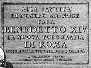
The general schema divides the entourage into two parts: Ancient Rome resides in the lower left corner and Modern Rome lies in the lower right portion of the map separated by a monumental marble slab with the map’s title and dedicatory inscription to Benedetto XIV. This feature can be identified as the Antonine pedestal located in the Piazza di Montecitorio (NN 86) in Nolli’s time and later moved to the Vatican. The inscription reads:

Translates to:
TO HIS HOLINESS POPE BENEDICT THE 14TH
THE NEW MAP OF ROME
IS OBSEQUIOUSLY OFFERED AND DEDICATED
BY HIS HUMBLE SERVANT
GIAMBATTISTA NOLLI OF COMO
Ancient Rome
The ancient theme in the lower left features the personification of
Rome and the recumbent River God representing the Tiber both as carved
statuary. In the foreground are ruined fragments that represent the
mythical founders of Rome, Romulus and Remus next to the remains of
the famous She Wolf that gave them suckle. The monuments which serve
as a backdrop to these figures are all recognizable ancient monuments
extant during Nolli’s time as well as today. The ancient monuments
with their numerical numbers are listed below from left to right:
Modern Rome
The modern theme in the opposing corner includes a living
personification of Rome receiving the Papal tiara from airborne putti,
the entire scene framed by modern buildings most prominent amongst
them being the Campidoglio, St. Peter’s Basilica, and S. John’s in the
Lateran. The juxtaposition of left and right sides suggests a knowing
awareness of Rome’s pagan past and Christian present and, with the
figures and building symbolizing antiquity in ruins, it conveys the
notion of a triumphant Church over paganism and a similar accession of
the modern world over the ancient now crumbling into ruins.
Modern monuments on the right include:
The putti that cavort throughout the lower portion of the map are
highly instructive. The first on the left is carving the papal
coat-of-arms of Benedetto XIV. The putti in the center are focusing on
a bussola (magnetic compass), noting, as in the wind rose on the map,
that the city plan is oriented according to magnetic north rather than
astronomical north, a significant detail reinforced in the map itself
and an important clue as to the surveying techniques used by Nolli.
An architectural scale in front of the dedicatory pedestal shows the
Roman Palmo, the traditional unit of measurement in Rome which
measures 223.4 millimeters or approximately 8.75 inches. The scale of
the original map, is approximately 1:2,900.
A note located just below the bussola further credits Nolli senior
giving his credentials as both architect and surveyor:
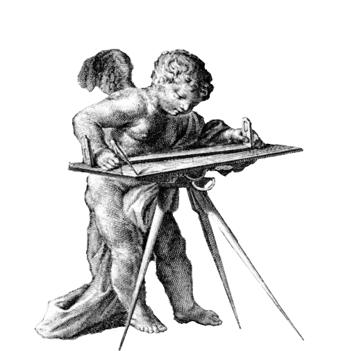
The group of putti to the right are shown busily at work surveying the city with the foreground putto using the alidade and bussola on a plane table to orient drawings and to render precise sight lines. The chains in use by the putti in the background are the same used by Nolli and his team to measure distances used in triangulation.
The engravers of the map are noted on the edge of the scroll and include Nolli’s son, Carlo, Rocco Pozzi Romano and Pietro Campana da Soriano.